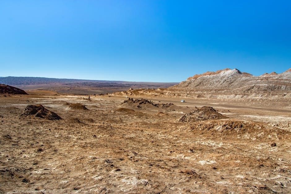
Site characterization, crucial for projects, involves detailed terrain assessment, aligning with MELCCFP guidelines and French norms.
This guide details methods for contaminated land, encompassing geophysical techniques and high-definition soil, water, and air expertise;
Importance of Thorough Site Investigation
A comprehensive site investigation is paramount for successful project execution and responsible land management, directly impacting safety and financial viability. Ignoring detailed terrain characterization can lead to unforeseen challenges, escalating costs, and potential environmental liabilities.
Understanding historical land uses, as highlighted in existing data reviews, is critical for identifying potential contamination sources. Thorough investigation informs appropriate remediation strategies, ensuring compliance with stringent norms and regulations. Accurate soil and groundwater analysis, utilizing techniques like those detailed in NF EN 12457-2 (leaching tests), safeguards human health and ecological integrity.
Moreover, a robust investigation minimizes project risks, optimizes design parameters, and facilitates informed decision-making throughout the project lifecycle. It’s a foundational step, preventing costly delays and ensuring sustainable development practices.
Regulatory Framework and Standards
Site characterization operates within a complex regulatory landscape, demanding adherence to specific frameworks and standards. In France, and internationally, these guidelines dictate the methodologies for assessing terrain conditions and potential contamination.
Compliance with norms like NF EN 12457-2, governing waste characterization and leaching tests, is essential for accurate contaminant identification and quantification. These standards ensure data reliability and comparability, facilitating informed risk assessment and remediation planning. The MELCCFP provides guidelines for terrain characterization, particularly for contaminated sites.
Understanding applicable regulations is crucial for legal compliance and responsible environmental stewardship. Proper documentation and adherence to established protocols are vital throughout the investigation process, safeguarding project integrity and minimizing potential liabilities.

Historical Site Assessment
Historical assessment involves reviewing existing data—maps, reports—to identify past land uses, crucial for understanding potential contamination sources and site history.
Review of Existing Data (Historical Maps, Reports)
A comprehensive review of existing data forms the cornerstone of historical site assessment. This process necessitates gathering and scrutinizing historical maps, aerial photographs, and any available reports pertaining to the site’s past activities. These documents can reveal previous land uses, potential sources of contamination, and the presence of underground structures or utilities.
Careful examination of these records helps establish a timeline of site usage, identifying periods where hazardous materials might have been handled or disposed of. This historical context is vital for interpreting subsequent investigation results and developing an effective site characterization strategy. The data review should also encompass regulatory records, fire insurance maps, and local archives to ensure a thorough understanding of the site’s history.
Identifying Past Land Uses
Determining past land uses is critical, as historical activities significantly influence present site conditions. This involves researching former industrial operations, agricultural practices, waste disposal areas, and any other potential sources of contamination. Identifying these past uses helps predict the types of contaminants likely present and their potential distribution across the site.
Investigating historical records, conducting interviews with local residents, and analyzing aerial photographs are essential steps. Understanding the sequence of land uses provides valuable insight into the site’s contamination history. This knowledge guides the selection of appropriate sampling locations and analytical parameters, ensuring a focused and efficient site characterization process. Accurate identification of past land uses minimizes risks and informs remediation strategies.
Geophysical Investigation Methods
Geophysical techniques, like Electrical Resistivity Tomography (ERT) and Ground Penetrating Radar (GPR), are vital for non-destructive site assessment and contaminant mapping.
Electrical Resistivity Tomography (ERT)
Electrical Resistivity Tomography (ERT) is a powerful geophysical method used extensively in site characterization, particularly for delineating subsurface geological structures and identifying potential contamination plumes. This technique involves injecting electrical current into the ground through an array of electrodes and measuring the resulting voltage differences.
Variations in electrical resistivity reflect changes in subsurface material properties, such as soil type, moisture content, and the presence of contaminants. ERT provides a two- or three-dimensional image of the subsurface resistivity distribution, allowing for the visualization of complex geological features and the detection of anomalies indicative of contamination. The interpretation of ERT data requires careful consideration of geological context and adherence to applicable norms for terrain interpretation, ensuring accurate and reliable results for environmental assessments.
Ground Penetrating Radar (GPR)
Ground Penetrating Radar (GPR) is a non-destructive geophysical technique employed in site characterization to image subsurface features. GPR transmits radio waves into the ground and records the reflections from interfaces between materials with differing dielectric properties. This method excels at identifying buried objects, utilities, and geological structures with high resolution.
The reflected signals are displayed as a radargram, which provides a cross-sectional view of the subsurface. GPR is particularly useful for mapping shallow subsurface conditions and detecting anomalies that may indicate contamination or geological hazards. Successful GPR surveys require careful consideration of site-specific conditions and adherence to established norms for data acquisition and interpretation, ensuring reliable results for terrain assessment and environmental investigations.

Soil Sampling Techniques
Soil sampling involves disturbed and undisturbed methods, crucial for characterizing soil properties and identifying contamination sources, following established principles and analytical parameters.
Disturbed vs. Undisturbed Sampling
Disturbed sampling alters the soil structure during collection, suitable for general soil classification and geochemical analysis, focusing on contaminant identification and quantification. This method is cost-effective and widely used for routine investigations, providing representative samples for many tests.
Conversely, undisturbed sampling preserves the soil’s original structure and in-situ stress conditions. Techniques like Shelby tube sampling are employed to maintain sample integrity, essential for determining physical properties such as permeability, consolidation characteristics, and shear strength. These samples are vital for geotechnical analyses and assessing soil behavior under load.
The choice between these methods depends on the specific objectives of the site characterization. Careful consideration of the required data and applicable norms, like those for soil testing (NF EN standards), guides the selection process, ensuring reliable and accurate results.
Sampling Depths and Frequency
Determining appropriate sampling depths and frequency is critical for accurate site characterization, guided by the project’s scope and potential contamination sources. Initial investigations often involve broader spacing, refined with targeted sampling based on preliminary findings.
Depth selection considers historical land uses and potential contaminant migration pathways. Sampling should extend to the depth of any identified or suspected contamination, as well as underlying strata that could act as conduits. Frequency increases in areas with heterogeneous soil conditions or known contamination plumes.
Adhering to general principles for designing sampling programs, as outlined in relevant methodologies, ensures comprehensive data collection. Proper documentation of sampling locations and depths is essential for data interpretation and compliance with applicable norms.

Soil Characterization – Physical Properties
Physical properties, like grain size analysis and Atterberg limits, define soil behavior and are fundamental to terrain assessment and engineering design.
Grain Size Analysis
Grain size analysis is a foundational physical property assessment, determining the distribution of different particle sizes within a soil sample. This crucial technique directly influences permeability, drainage characteristics, and overall soil behavior. Typically, soils are categorized by size – gravel, sand, silt, and clay – each impacting engineering properties differently.
Methods include sieve analysis for coarser particles and hydrometer analysis for finer fractions. Accurate determination of these distributions is vital for classifying soils, predicting settlement, and designing appropriate foundations. The results inform decisions regarding compaction methods, erosion control, and the suitability of the soil for various construction purposes. Proper execution and interpretation of grain size analysis are essential components of comprehensive site characterization.
Atterberg Limits (Plasticity Characteristics)
Atterberg Limits define a soil’s plasticity – its ability to deform under applied stress – and are fundamental to characterizing fine-grained soils (silts and clays). These limits, including the Liquid Limit (LL), Plastic Limit (PL), and Shrinkage Limit (SL), delineate states transitioning between solid, plastic, and liquid behavior.
The Plasticity Index (PI), calculated as LL-PL, quantifies the range of moisture content over which the soil exhibits plastic properties. These parameters are critical for assessing soil compressibility, shear strength, and permeability. They directly influence foundation design, slope stability analysis, and earthwork construction. Accurate determination of Atterberg Limits is therefore a cornerstone of effective site characterization, providing vital insights into soil behavior.
Soil Characterization – Geochemical Analysis
Geochemical analysis identifies and quantifies contaminants, adhering to standards like NF EN 12457-2 for leaching tests, crucial for terrain assessment.
Contaminant Identification and Quantification
Contaminant identification is a pivotal stage, demanding rigorous geochemical analysis of soil samples to pinpoint the presence of pollutants. This process involves employing advanced analytical techniques to detect a wide spectrum of potential contaminants, including heavy metals, volatile organic compounds (VOCs), and persistent organic pollutants (POPs).
Following identification, quantification becomes essential, determining the concentration of each contaminant present. Accurate quantification is vital for risk assessment and remediation planning, ensuring compliance with relevant environmental regulations and standards. The selection of appropriate analytical methods depends on the suspected contaminants and the required detection limits.
Furthermore, understanding contaminant behavior, including leaching potential assessed via NF EN 12457-2, is crucial. This data informs strategies for minimizing environmental impact and protecting human health, ultimately guiding effective site management and remediation efforts.
Relevant Standards (e.g., NF EN 12457-2 ― Leaching tests)
Adherence to established standards is paramount throughout site characterization, ensuring data reliability and regulatory compliance. NF EN 12457-2, specifically, governs waste characterization through leaching tests, crucial for assessing the potential for contaminants to migrate from soil into groundwater.
These tests simulate environmental conditions to determine the release rate of hazardous substances, informing risk assessments and remediation strategies. Beyond leaching, other relevant standards dictate protocols for sampling, analysis, and reporting, guaranteeing consistency and comparability of results.
French norms for soil testing, alongside European standards, provide a framework for evaluating soil properties and contaminant levels. Strict adherence to these guidelines is essential for accurate site assessment and responsible environmental management, safeguarding both human health and ecological integrity.

Groundwater Investigation
Groundwater assessment involves installing monitoring wells for sampling and analysis, crucial for identifying subsurface contamination and evaluating hydrogeological conditions.
Monitoring Well Installation
Monitoring well installation is a pivotal step in groundwater investigation, demanding meticulous planning and execution to ensure representative sample collection. Proper site selection considers hydrogeological factors, contaminant plume direction, and accessibility for long-term monitoring. Borehole drilling employs appropriate techniques based on geological conditions, followed by well casing installation – typically PVC or stainless steel – with screened intervals opposite the target aquifer.
Gravel pack placement around the screen enhances hydraulic connectivity, while a bentonite seal prevents surface water infiltration. Well development, through surging or pumping, removes drilling fluids and stabilizes water parameters. Accurate well logging, including depth, screen interval, and geological strata, is essential for data interpretation. Finally, secure well completion with a protective casing and lock safeguards against vandalism and contamination, ensuring data integrity throughout the monitoring program.
Groundwater Sampling and Analysis
Groundwater sampling requires stringent protocols to obtain representative data, minimizing disturbance and preventing cross-contamination. Prior to sampling, well parameters like static water level, temperature, and pH are measured. Low-flow purging, using dedicated pumps, stabilizes conditions before sample collection, reducing turbidity and ensuring accurate analysis.
Samples are collected in appropriate containers, preserved according to analyte requirements, and transported under chain-of-custody to accredited laboratories. Analysis encompasses a range of parameters, including dissolved metals, volatile organic compounds (VOCs), and general chemistry. Data validation confirms analytical accuracy and identifies potential anomalies; Results are then interpreted in conjunction with hydrogeological data to assess groundwater quality and identify contaminant sources, informing remediation strategies.

Data Interpretation and Reporting
Data interpretation correlates geophysical and geochemical findings, applying relevant terrain norms for accurate assessment and comprehensive reporting of site conditions.
Correlation of Geophysical and Geochemical Data
Correlating geophysical investigations – like Electrical Resistivity Tomography (ERT) and Ground Penetrating Radar (GPR) – with geochemical analyses is paramount for robust site characterization. Geophysical methods delineate subsurface anomalies, providing a broad spatial understanding of potential contamination plumes or geological features.
However, these methods are often non-specific. Geochemical data, identifying contaminant types and concentrations, provides the necessary specificity. Integrating both datasets allows for a more accurate three-dimensional model of the subsurface. For instance, a low resistivity zone identified by ERT, coupled with elevated contaminant levels from soil sampling, strongly suggests a localized contamination source.
This integrated approach minimizes ambiguity and enhances confidence in the interpretation, ultimately leading to more effective remediation strategies and informed decision-making regarding land use and risk assessment, adhering to applicable terrain interpretation norms.
Applicable Norms for Terrain Interpretation
Terrain interpretation relies heavily on adherence to established norms and standards, ensuring data quality and legal compliance. In France, Norme NF EN 12457-2 is crucial for characterizing waste through leaching tests, vital for assessing contaminant mobility from soils. Furthermore, French standards govern soil testing procedures for conventional soil investigations.
Beyond leaching tests, relevant norms dictate acceptable analytical methods for contaminant identification and quantification. These standards specify quality control protocols, detection limits, and reporting requirements. Proper application of these norms guarantees the reliability and defensibility of site characterization data.
Understanding and implementing these regulations is essential for accurate risk assessment, effective remediation planning, and fulfilling legal obligations related to land contamination and environmental protection, ultimately safeguarding human health and the environment.
Related Posts

google scholar recherche mémoire pdf
Google Scholar for Thesis Research: Finding PDFs Google Scholar, celebrating…

volvo penta service manual pdf
Volvo Penta service manuals (PDF) are crucial for owners and…

west coast trail map pdf
West Coast Trail Map PDF: A Comprehensive Guide (Updated 02/05/2026)…